BEE MAY 2021
San José de Magdalena to Mulegé via Sierra Guadalupe
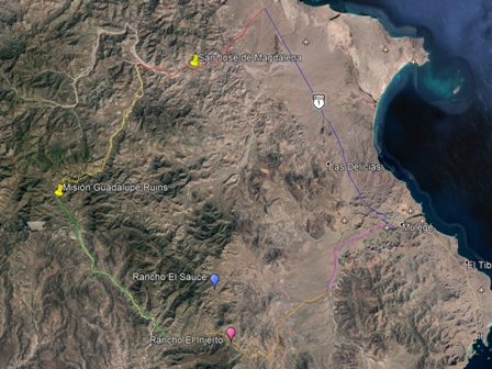
Image source: Google Earth 2021
Key to approx. leg distances:
Blue=33 km; Red=22 km; Yellow=25 km; Green=25 km; Orange=27 km; Pink=14 km.
When I asked my friend Javier where we should go on our next outing in March to the sierras, he suggested we do a loop from San José de Magdalena (SJdM), into the mountains to the old Misión de Guadalupe, and then down the hill past San Patricio into the Mulegé valley (see map at right). The 145 km (90 mile) trip in Javier's 4-seater buggy took six long, very hot hours, traversed sandy arroyos, climbed to 2700 ft through narrow, rocky canyons, and then descended a number of grades with hairpin turns. Read on to see some of the amazing backcountry we passed through. Unfortunately, it was very dry and we did not encounter any standing water. After bouncing around for a few hours, I was too tired and achy to search for moss or ferns.
For more Sierra Guadalupe trips, see: Apr 2013 (SJdM); May 2014 (Pacific route to La Ballena); Jun 2015 (SJdM); Jan 2018 (Arroyo las Chuparrosas in southern valley); Jan 2019 (Sierra Zacatecas & Sierra Guadalupe via Pacific route); and Jul 2020 (Arroyo San Nicolás & SJdM).
Mulegé to Arroyo Pie de la Cuesta — 55 km
We started our trip in Mulegé and took the highway 33 km north to the turnoff to San José de Magdalena. This leg climbs from near sea level at Mulegé to about 900 feet through the lower western flank of the Sierra de Guadalupe and drops back down into the Arroyo San José de Magdalena at around 740 feet. Eight km west of SJdM, we reached the point where Arroyo Pie de la Cuesta joins the main arroyo from the south at about 1000 ft elevation. (See paths in blue and red on map).
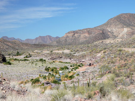
Descending into Arroyo San José de Magdalena from the highway.
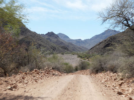
Starting south along Arroyo Pie de la Cuesta.
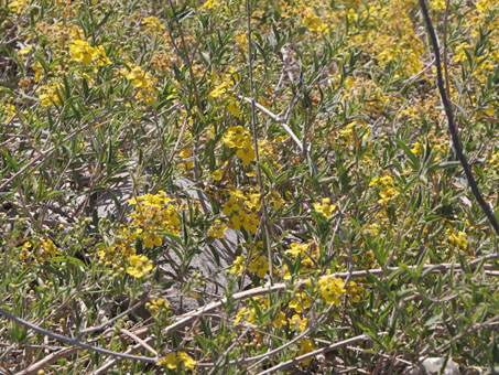
Butterfly Vine / Gallineta (Callaeum macropterum, Malpighiaceae), a woody perennial vine common in arroyos and loose, disturbed soils.
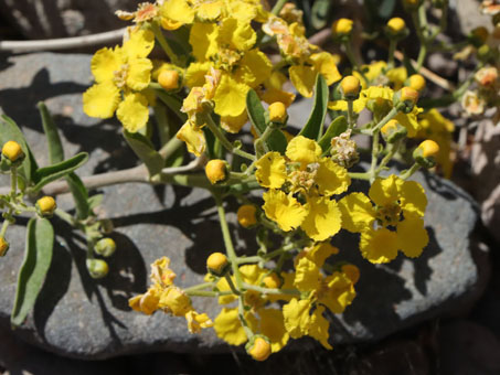
Butterfly Vine/Gallineta (Callaeum macropterum). Flowers are c. 1.5-2 cm D.
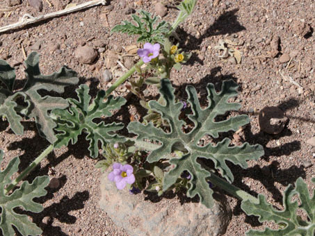
Baja California Coyote Melon leaves (Cucurbita cordata, Cucurbitaceae) and the lavender flowers of Nama coulteri (Namaceae).
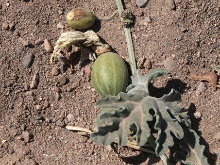
Young pepo (fruit) of Baja California Coyote Melon.
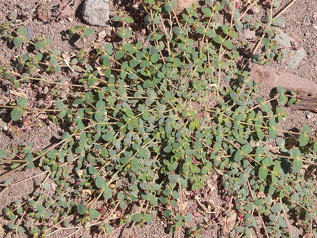
Small-seed Sandmat (Euphorbia polycarpa var. polycarpa, Euphorbiaceae).
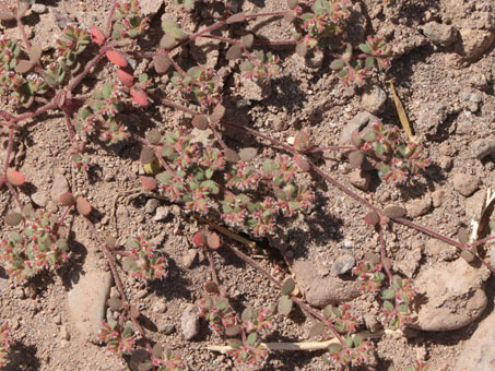
A different species, Yuma Sandmat or Fringe Spurge (Euphorbia setiloba) right next to the first.
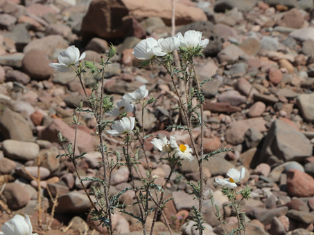
A small group of Prickly Poppy (Argemone gracilenta, Paperveraceae).
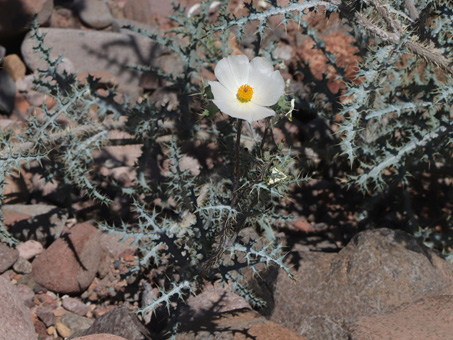
Prickly Poppy (Argemone gracilenta) can stand over 1 m tall with flowers 6-7 cm D.
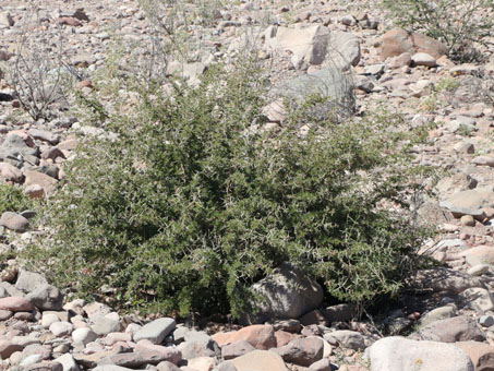
A young Brandegee Acacia/Vinorama (Vachellia brandegeana, Fabaceae), a BCS endemic shrub or small tree. This one looks munched.
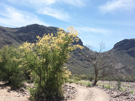
A number of the Brandegee Acacias were blooming, and lit up like torches by the sun, were visible from afar.
Arroyo Pie de la Cuesta to Mision Guadalupe Ruins — 15.8 km
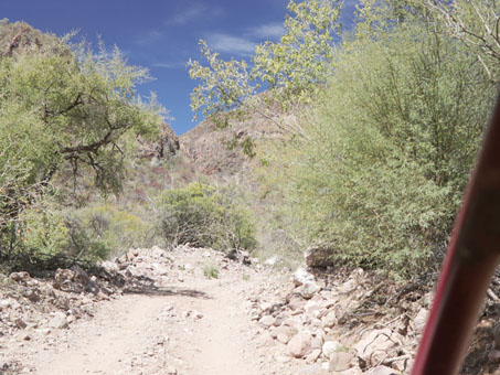
This leg started with a gradual ascent over 16 km from 980 ft elevation mostly along the arroyo bottom until we reached a narrowing in the canyon with steep cliffs on both sides at about 1700 ft elevation. From that point, it was what seemed an interminable uphill haul (but was only 4 km) to the summit another 1000 ft high. But what a thrill! The more gradual descent to the mission ruins 400 ft below was another 4 km. (See yellow path on map).
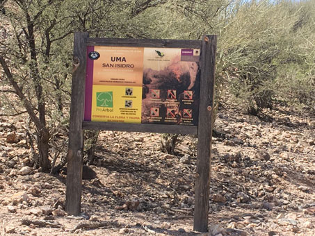
UMA San Isidro is an area under wildlife management where supervised hunting is permitted.
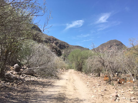
Heading up the arroyo, the vegetation along the canyon bottom became more dense.
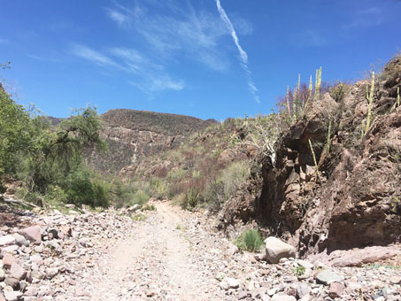
Compared to around Mulegé, the vegetation at about 1500 ft here was quite green.
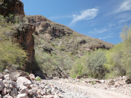
The road up the canyon continued to narrow and climb (1650 ft).
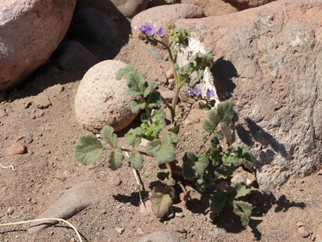
Southern Mountain Phacelia/Rama Zorilla (Phacelia scariosa, Hydrophyllaceae), a lovely but skunky native annual.
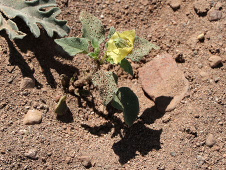
Thick-leaf Groundcherry/Tomatillo (Physalis crassifolia var. crassifolia, Solanaceae). The pendant flower is c. 2 cm D.
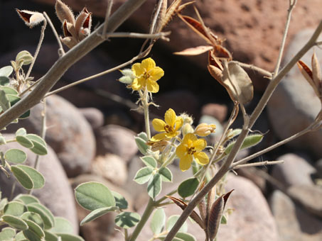
Gulf Cassia/Hojasén (Senna confinis, Fabaceae) is a near peninsular endemic that occurs from Bahía de los Ángeles to the Cape.
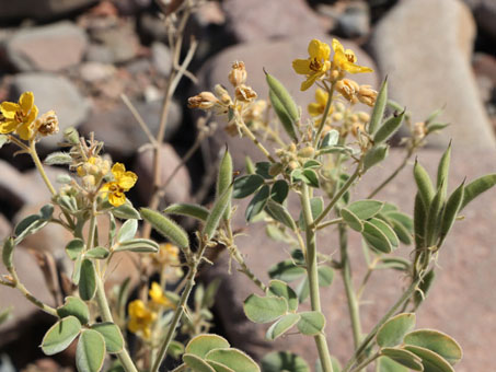
The plant is velvety soft. It is a host plant for some endemic sulphur butterfly larvae.
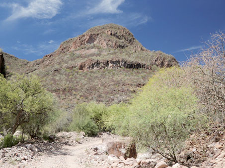
Many of the trees and cacti in the canyon bottom were very tall. Mesquites (Prosopis articulata), Palo Verde (Parkinsonia florida)...
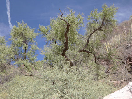
Not sure what these tall trees are. Trunk and branches very dark and spiny, the leaves leaves (not pinnate).
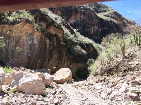
Entering a narrow tunnel, with rock slab on the left, almost overhanging the road, and dense shrubs and trees on the right.
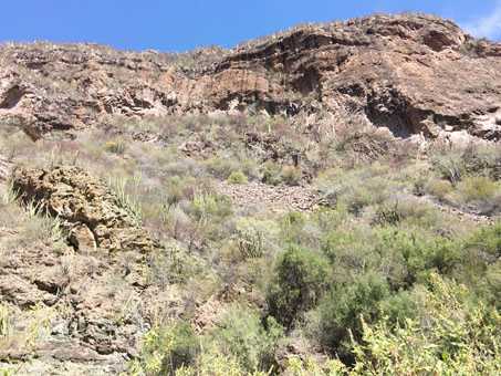
We caught occasional glimpses of the towering cliffs to our right. The rock face looked as if it had been scraped by a gigantic claw & the tall, Organpipe and Cardón cactus mirrored the scrapes, accentuating them.
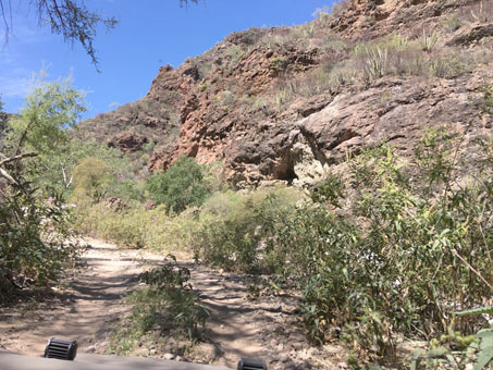
A pause in the climb to dip into the bottom of the arroyo where the Canyon Ragweed/Chicura del Arroyo (Ambrosia ambrosioides, Asteraceae) was taller than the buggy and brushed against its sides.
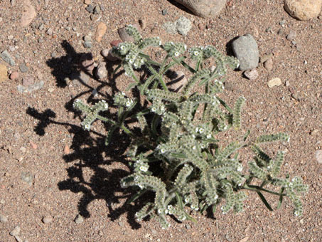
One of the few annuals, Gray Cryptantha/Nievitas (Johnstonella sp. Boraginaceae) finds a hospitable place in the arroyo bottom.
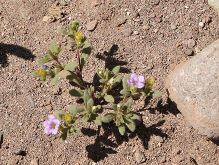
Likewise, the endemic annual purplemat (Nama coulteri, Namaceae) takes hold.
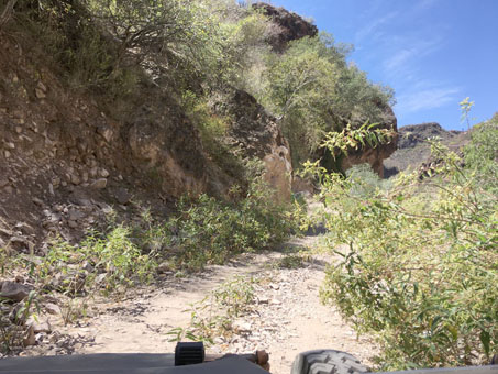
More twisting and turning along the arroyo through the Canyon Ragweed and along the rocky overhang.
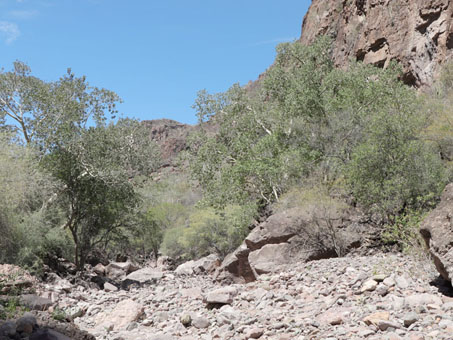
The trees in this arroyo & perched on the cliffs were enormous: 20-30 foot tall Wild Figs (Ficus petiolaris, Moraceae), Palo Blancos (Lysiloma candida, Fabaceae) & Mesquites (Prosopis articulata, Fabaceae).
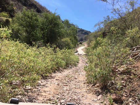
Finally through the bottom of the canyon, the road begins the long grade up the mountain side (c. 2035 ft).
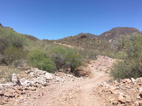
By this point, we had just climbed a crazy, narrow, long uphill grade with a switchback to 2526 ft high, only to start down again & see in the distance yet another long uphill climb soon to come.
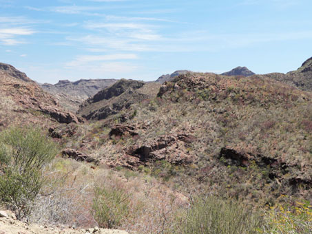
Near the top of the grade at about 2700 ft.
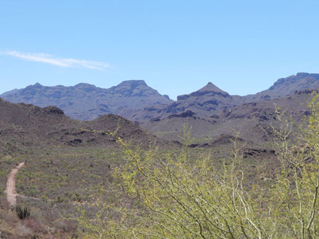
View from 2590 ft, as we headed down the other side of the divide into Arroyo Guadalupe. The mountains in the distance reach about 3950 ft in elevation. Palo Verde (Parkinsonia florida) in foreground.
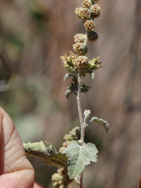
While taking a pee break, I found myself staring right into a flowering Sonoran Bur-sage (Ambrosia cordifolia, Asteraceae), a species new to me.
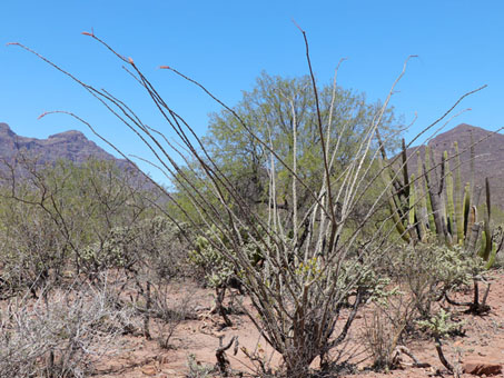
The pit-stop was initially inspired by the sudden appearance of Ocotillo (Fouquieria splendens, Fouquieriaceae), a species that only occurs in this part of the state at higher elevations, such as here at 2380 ft.
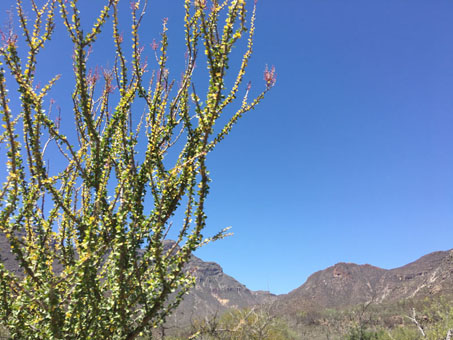
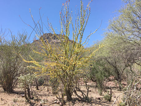
It was common to see the Palo Adán looking like this, green leaves turning bright yellow below, new reddish inflorescences near the tips.
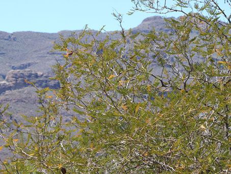
Another new species for me: Kellogg Acacia/Garabatilla de Espina Negra (Senegalia kelloggiana, Fabaceae).
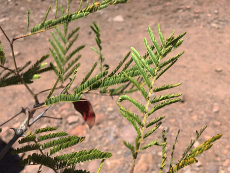
The often flat (horizontal) posture of the fine, pinnate leaves gives this BCS endemic shrub an indistinct, wispy quality.
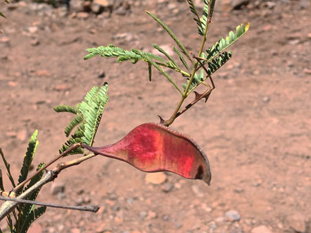
The spines are flat, sharp cat-claws. The length and shape of the beans are irregular: reddish here, dark brown and variously constricted with maturity; the tip is apiculate to acuminate.
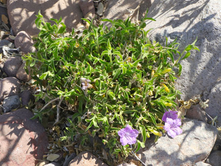
A rare sight on this trip: Flor de Campo (Ruellia californica, Acanthaceae) in bloom and looking lush.
Misión Guadalupe Ruins to Mulegé - La Ballena junction — 15.6 km
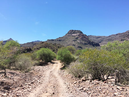
Heading downslope into the Arroyo de Guadalupe and closing in on the old Mision de Guadalupe, the vegetation is still dense and green.
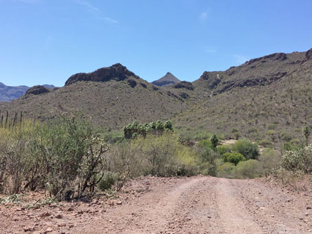
The tall, dark trees clustered in the middle are palms.
Though I didn't get a closeup look at the palms, they are likely Brandegee Fan Palms/Palma de Tlaco (Brahea brandegeei, Arecaceae), an endemic species common at higher elevations throughout BCS. Rebman et al. (2016) says that the palms in this area may actually be an undescribed species, different from those common in the Cape.
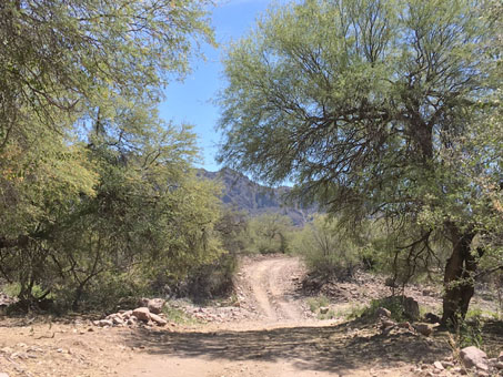
Southward along the Arroyo de Guadalupe.
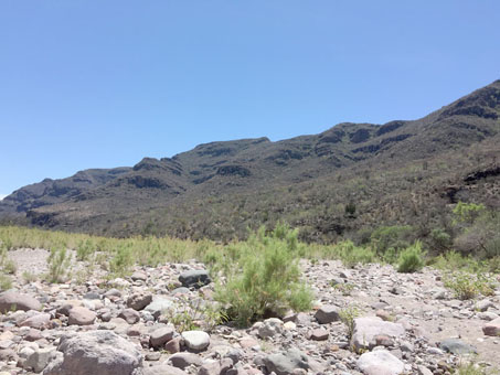
In this arroyo crossing, all the green is almost entirely from Leafy Burrobush (Ambrosia monogyra, Asteraceae).
In other crossings, there were what appeared to be monocultures of Spiny Aster/Buena Mujer (Chloracantha spinosa var. spinosissima, Asteraceae), Bebbia juncea var. juncea (Asteraceae) or Baja California Rocknettle (Eucnide cordata, Loasaceae).
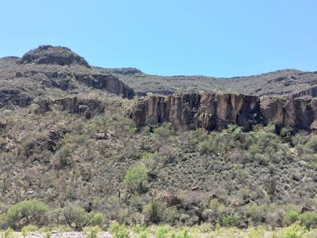
West wall of the Arroyo Guadalupe. Lots of tall trees in the arroyo bottom and large cacti on the hillsides. The vegetation was getting noticeably less green the farther south we went.
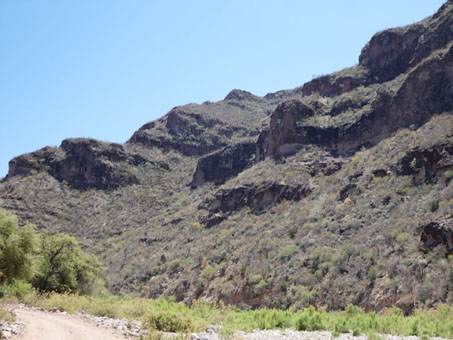
Species included: Organpipe Cactus (Stenocereus thurberi), Cardón (Pachycereus pringlei) and Wild Fig (Ficus petiolaris). (c. 1790 ft)
La Ballena-Mulegé junction to Arroyo El Potrero — 26.8 km
The road from Misión Guadalupe meets the main route between the Gulf and the Pacific coast at about 1620 ft and 41 km west of Mulegé. A large government sign indicated that the road was being improved, and on the descent along Arroyo San Gabriel towards Mulegé, it was evident in various places from the widened road bed, graded surface and, on some steep grades, cement paving.
(See orange path on map).
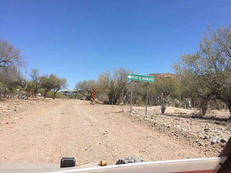
Rancho El Aguajito is just east of this junction.
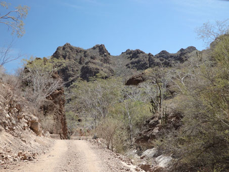
At about 1590 ft, starting to descend the eastern escarpment beyond Rancho El Aguajito. The change in vegetation started gradually south of Misión Guadalupe; it just kept getting drier and drier on this leg.
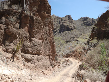
One of the narrow parts, rock on one side, drop off on the other.
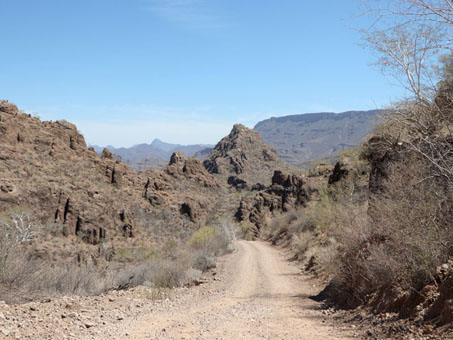
Down, down, down we went. This stretch is a lot like a roller coaster with deep ups and downs, and curves around and between rock outcrops (c. 1460 ft).
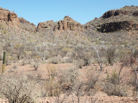
We dropped quickly to just over 900 ft by this point and the vegetation looks much like it does at sea level around Mulege...
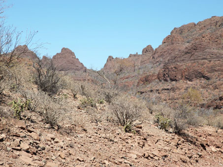
...shrubs and trees with few to no leaves and lots of open ground between plants.
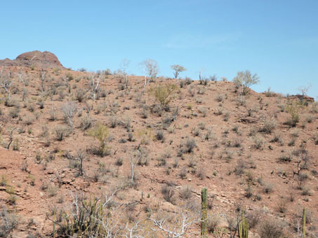
The vegetation at 700 ft elevation just west of the Mulegé basin just above Arroyo San Patricio looks like it currently does at sea level.
Wow, what a trip! Everyone and everything was covered in a fine layer of dirt for most of the day: windshield, helmets, cameras, my clothes that gave off a fine mist of silt every time I moved. But by the end of the long ride, we were all feeling a little giddy.
I was amazed at the scale of the mountains and the open space. There is so much to see out here and we covered but a tiny portion of the sierra that day. Hopefully I´ll have more opportunities to explore there soon. So, until next time, hasta pronto...
Debra Valov—Curatorial Volunteer
References
Rebman, J. P., J. Gibson, and K. Rich, 2016. Annotated checklist of the vascular plants of Baja California, Mexico. Proceedings of the San Diego Society of Natural History, No. 45, 15 November 2016. San Diego Natural History Museum, San Diego, CA. Full text available online.
Rebman, J. P and Roberts, N. C. (2012). Baja California Plant Field Guide. San Diego, CA: Sunbelt Publications. Descriptions and distribution.
Valov, D. (2020). An Annotated Checklist of the Vascular Plants of Mulegé, Baja California, Mexico. Madroño 67(3), 115-160, (23 December 2020). https://doi.org/10.3120/0024-9637-67.3.115
Wiggins, I. L. (1980). The Flora of Baja California. Stanford University Press. Keys and descriptions.


