PDF version of guide for easy web reading
ESPAÑOLDownload a printable version of the Plant and Trail Guide (print, collate, fold and staple)
PDF version of guide for easy web reading
ESPAÑOLDownload a printable version of the Plant and Trail Guide (print, collate, fold and staple) |
| HOME | ECOAMIGOS DE MULEGÉ | ISSI | NATURAL HISTORY | CONSERVATION | BAJA PLANTS | GALLERIES | LINKS | ABOUT |
| Trail and Plant Guide: Mesa del Rincón San Ignacio, BCS | |
 |
|
| Guide Main | Trail Descriptions | Trail Map | Plant List TRAILS: El Camino Real | La Vista del Cañon | La Virgen de Guadalupe | Los Corralitos | El Atajo | El Malpaisal | El Arrecife |
|
| TABLE OF CONTENTS Introduction (Location, Climate, Vegetation, Safety Issues, Trail Etiquette) |
|
Introduction |
|
 Click image to enlarge |
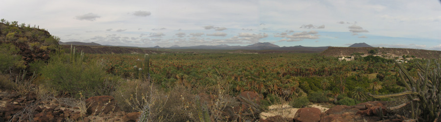
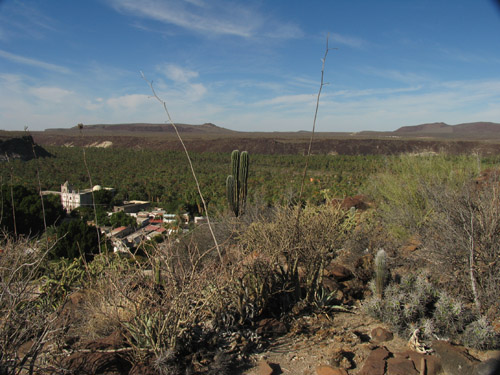
Location San Ignacio is nestled in a side canyon of the San Ignacio Arroyo and is bordered on the south and west by a single large mesa that is split in three by smaller canyons. With its geological history, lava flows (both sheet and block), tinajas (seasonal, natural rock pools), variety and density of vegetation, archeological and cultural points of interest, and fantastic vistas, Mesa Rincón is by far the most interesting of the three mesas. The main path up to the mesa is called the Camino Real trail, and is a fragment of the “King’s Highway” that connected the missions of Alta and Baja California. This section led southward into the Sierras and connected San Ignacio to the Guadalupe, Purísima, Comondú and San Javier missions. |
 Climate ClimateSan Ignacio is located in the central region of the Baja California peninsula. It is warm or hot and dry much of the year, though winter morning temperatures can be quite chilly. The best time for most people to visit the mesa is between October and April, when day time temperatures are milder. Except for early morning hours, the summer months can be brutal as the trees have few leaves and shade is hard to find on the mesa. Make a visit to the mesa part of your Baja California gray whale-watching trip. Plan on a half-day (4 hours) to enjoy the walk at a leisurely pace and explore the plant life. For a longer stay in town, spend a few days exploring the different parts of the mesa. For seasoned hikers and botanical enthusiasts, learn to recognize the plants on Mesa Rincón then climb the steeper mesa known as Mesa de la Cruz on the town’s northeast edge. Maps are available at Casa Lereé and the web sites listed on the back of this pamphlet. Vegetation Many of the trees and shrubs of the region spend a great deal of their life cycle in a dormant, leafless state, often resembling masses of dead twigs. These drought deciduous plants (such as Lomboy, Matacora, Palo Verde and Palo Adán) only produce leaves when there is ample moisture. Please be cautious and don’t break off branches or uproot these shrubs, nor trample on these seemingly “dead” plants, or they soon will be dead. Please stay on the trails as much as possible and avoid trampling and compacting soils around the bases of plants. Do not collect live specimens of any plants. Note: all cacti are protected by federal and international laws and treaties.
The plant list at the end of this booklet was compiled after visits to the area in December 2009 and 2010, as well as April 2011, so many late spring or summer annuals and perennials are not well represented in the inventories made. Distances and elevations are approximate, with many calculated as straight lines between GPS waypoints. GPS coordinates are based on the WGS84 data set, so accuracy will depend on the model and settings of the GPS used. Coordinates correspond well with Google Earth maps. Plants measurements are given in metric units, while distances are both in English and Metric units. Illustrations were created from photographs of live plants and are not necessarily to scale if compared with illustrations of the same or other species. Species names in parentheses that appear within titles of plant descriptions are synonyms (usually outdated names) of the name they appear after. 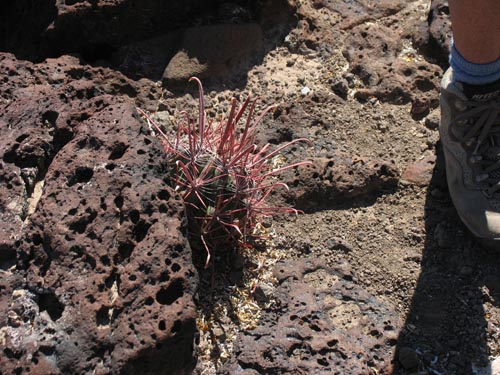
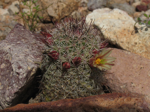
Plants like this young Barrel Cactus present hidden dangers along the trail |
|
| All text, images and files are copyrighted © 2012 by LasEcomujeres.com unless otherwise credited. To obtain permission for personal, academic, commercial, or other uses, or to inquire about high resolution images, prints, fees, or licensing, or if you have other questions, contact: info@lasecomujeres.org The thumbnail photos on this page may be freely used for personal or academic purposes without prior permission under the Fair Use provisions of US copyright law as long as the photo is clearly credited with Copyright © 2009 LasEcomujeres.com For other uses, contact us. |
| info@lasecomujeres.org |
| 21-Mar-2012 |
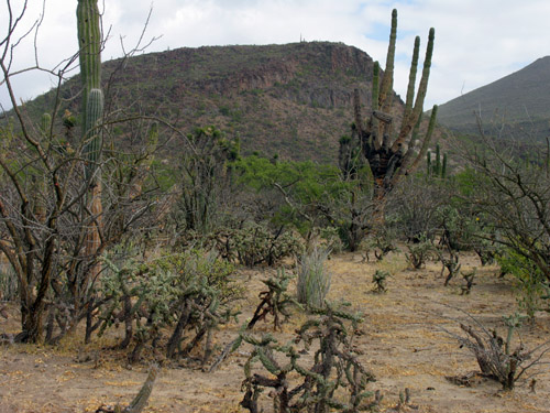 of the xerophytic desert scrub of the Sonoran Desert found here in the central peninsula. Drought-adapted plants such as those with succulent stems or thick trunks (as seen in the cacti and Elephant trees), or shrubs and small trees with tiny, deciduous leaves (like Mesquite, Palo Verde and Desert Ironwood) dominate the landscape. Annuals and perennials make their appearance in times of abundant rain.